File:USA West Virginia location map.svg

Size of this PNG preview of this SVG file: 644 × 599 pixeles. Altri resolutiones: 258 × 240 pixeles | 516 × 480 pixeles | 825 × 768 pixeles | 1,100 × 1,024 pixeles | 2,200 × 2,048 pixeles | 1,201 × 1,118 pixeles.
Original file ((file SVG, nominalmen 1,201 × 1,118 pixeles, mesura de file: 523 KB))
Descrition
| Descrition |
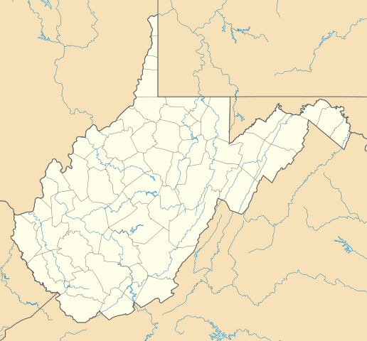
Deutsch: Positionskarte von West Virginia, USA
Quadratische Plattkarte, N-S-Streckung 130.0 %. Geographische Begrenzung der Karte:
English: Location map of West Virginia, USA
Equirectangular projection, N/S stretching 130.0 %. Geographic limits of the map:
|
||
| Date | |||
| Fonte | Propri ovre | ||
| Autor | Alexrk2 | ||
| Other versions | Derivative works of this file: Wawa footprint 2012-07.png | ||
| SVG genesis |
|

Derivative works of this file:
Autorisation
I, the copyright holder of this work, hereby publish it under the following licenses:

|
Permission es concedet por copiar, distribuer e/o modificar ti document sub li conditiones del Autorisation de Documentation Líber del GNU, Version 1.2 o qualcunc version posteriori publicat per li Free Software Foundation; che nequant Section Ínvariant, nequant Textu de Covriment, e nequant Textu de Contra-Covriment. Un copie del autorisation es includet in li section nominat Autorisation de Documentation Líber del GNU. |
This file is licensed under the Creative Commons Attribution 3.0 Unported license.
- Vu es líber:
- distribuer – a copiar, distribuer e transmisser li labor
- remixter – adaptar li ovre
- Sub li conditiones quam seque:
- atribution – Vu deve dar li credite convenent, provider un catenun por li autorisation, e indicar si changes esset fat.
Vu posse far in qualcunc forme rasonabil, ma ne de forma que suggeste que li autorisator indossa vu o tui usu.
Vu posse selecter li autorisation de tui selection.
Versiones del file
Clacca a un date/témpore por vider ti version.
| Version de | Miniatura | Dimensiones | Usator | Comentarie | |
|---|---|---|---|---|---|
| actual | 15:31, 3 julí 2009 | | 1,201 × 1,118 (523 KB) | Alexrk2 | == Beschreibung == {{Information |Description= {{de|Positionskarte von West Virginia, USA}} Quadratische Plattkarte, N-S-Streckung 130.0 %. Geographische Begrenzung der Karte: * N: 40.8° N * S: 37.0° N * W: 82.8° W * O |
Usu del file
Hay nequant págine que usa ti file.
Usu global del file
Li altri wikis a sequer usa ti-ci file:
- Usu in an.wikipedia.org
- Usu in ar.wikipedia.org
- Usu in azb.wikipedia.org
- دانلو، باتی ویرجینیا
- پوینتس، باتی ویرجینیا
- تالمنزویل، باتی ویرجینیا
- جراردزتاون، باتی ویرجینیا
- لندقراف، باتی ویرجینیا
- کیربی، باتی ویرجینیا
- کوالوود، باتی ویرجینیا
- آقوستا، وست ویرجینیا
- های ویو، باتی ویرجینیا
- قلنقری، باتی ویرجینیا
- اسلینزویل، باتی ویرجینیا
- شنکس، باتی ویرجینیا
- دلری، باتی ویرجینیا
- پرجیتسویل، باتی ویرجینیا
- یلو اسپرینق، باتی ویرجینیا
- هوکس میلز، باتی ویرجینیا
- ریپان، باتی ویرجینیا
- نورت ریور میلز، باتی ویرجینیا
- اسلب فورک، وست ویرجینا
- راک کیو، باتی ویرجینیا
- فورکس آو کاکاپون، باتی ویرجینیا
- نایبرت، باتی ویرجینیا
- لیتل کاکیپون، باتی ویرجینیا
- لولز، باتی ویرجینیا
- ایوانز، باتی ویرجینیا
- بیکر، باتی ویرجینیا
- کپون اسپرینقز، باتی ویرجینیا
- ماونت استورم، باتی ویرجینیا
- سامیت پوینت، باتی ویرجینیا
- اتول، باتی ویرجینیا
- اجوود، باتی ویرجینیا
- ادنا، باتی ویرجینیا
- ارباکان، باتی ویرجینیا
- ارین، باتی ویرجینیا
- ازبری، باتی ویرجینیا
- اسرائیل، باتی ویرجینیا
- اسکو، باتی ویرجینیا
- اشتون، باتی ویرجینیا
- اشلند، باتی ویرجینیا
- اطلس، باتی ویرجینیا
- افتن، باتی ویرجینیا
- اکسچنج، باتی ویرجینیا
- اکمن، باتی ویرجینیا
Vider plu del usu global de ti-ci file.