File:Reconstructed Mesolithic round-house - geograph.org.uk - 1091110.jpg
Dimension de ci prevision: 800 × 577 pixeles. Altri resolutiones: 320 × 231 pixeles | 640 × 462 pixeles | 1,024 × 739 pixeles | 1,280 × 924 pixeles | 2,220 × 1,602 pixeles.
Original file (2,220 × 1,602 pixeles, dimension del file: 2.72 MB, tip MIME: image/jpeg)
Descrition
| Descrition |
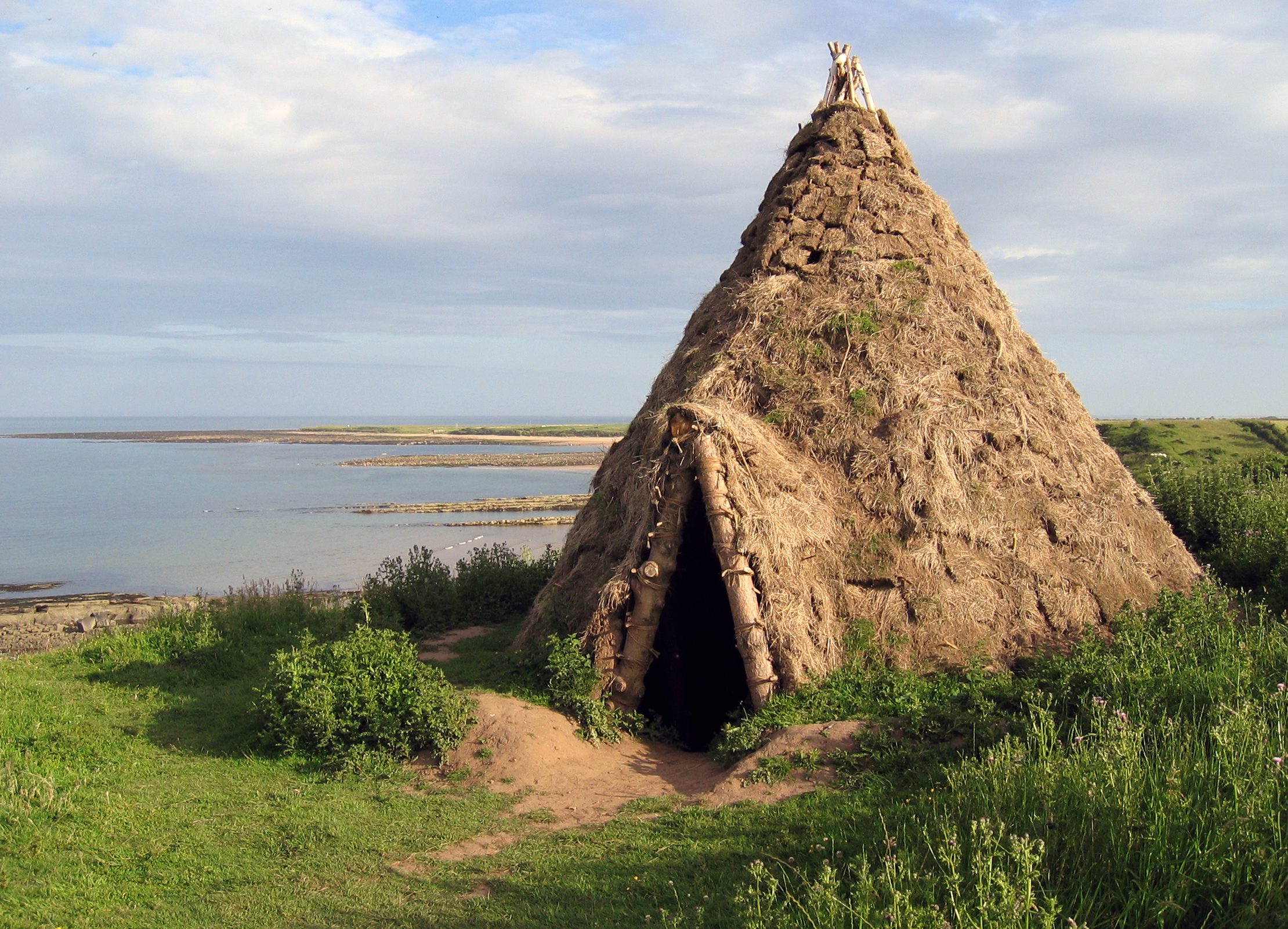
English: Reconstructed Mesolithic round-house Replica of a 10,000 year old round-house which was excavated from a nearby cliff-top site which had been discovered by the identification of flint artifacts in the eroding cliffs by amateur archaeologists. |
| Date | |
| Fonte | From geograph.org.uk |
| Autor | Andrew Curtis |
| Atribution (required by the license) | Andrew Curtis / Reconstructed Mesolithic round-house / |
| Camera location | | View this and other nearby images on: OpenStreetMap |
|---|
_heading:135.00&language=ie)
| Object location | | View this and other nearby images on: OpenStreetMap |
|---|
_heading:135.00&language=ie)
Autorisation

|
This image was taken from the Geograph project collection. See this photograph's page on the Geograph website for the photographer's contact details. The copyright on this image is owned by Andrew Curtis and is licensed for reuse under the Creative Commons Attribution-ShareAlike 2.0 license.
|
This file is licensed under the Creative Commons Attribution-Share Alike 2.0 Generic license.
Atribution: Andrew Curtis
- Vu es líber:
- distribuer – a copiar, distribuer e transmisser li labor
- remixter – adaptar li ovre
- Sub li conditiones quam seque:
- atribution – Vu deve dar li credite convenent, provider un catenun por li autorisation, e indicar si changes esset fat.
Vu posse far in qualcunc forme rasonabil, ma ne de forma que suggeste que li autorisator indossa vu o tui usu.
- distribuer in conditiones de egal autorisation – Si vu remixter, transformar, o constructer sur li materiale, vu deve distribuer tui contributiones sub li autorisation identic o campatabil quam li original.
Versiones del file
Clacca a un date/témpore por vider ti version.
| Version de | Miniatura | Dimensiones | Usator | Comentarie | |
|---|---|---|---|---|---|
| actual | 16:56, 19 may 2020 | | 2,220 × 1,602 (2.72 MB) | Geograph Update Bot | Higher-resolution version from Geograph. |
| 15:05, 24 februar 2011 |  | 640 × 462 (85 KB) | GeographBot | == {{int:filedesc}} == {{Information |description={{en|1=Reconstructed Mesolithic round-house Replica of a 10,000 year old round-house which was excavated from a nearby cliff-top site which had been discovered by the identification of flint artifacts in t |
Usu del file
Li sequent págine usa ti file:
Usu global del file
Li altri wikis a sequer usa ti-ci file:
- Usu in de.wikipedia.org
- Usu in en.wikipedia.org
- Usu in fr.wikipedia.org
- Usu in hr.wikipedia.org
- Usu in ru.wikipedia.org
- Usu in www.wikidata.org