File:Malaysia states named.png

Dimension de ci prevision: 800 × 274 pixeles. Altri resolutiones: 320 × 109 pixeles | 640 × 219 pixeles | 1,500 × 513 pixeles.
Original file (1,500 × 513 pixeles, dimension del file: 163 KB, tip MIME: image/png)

|
This map image could be re-created using vector graphics as an SVG file. This has several advantages; see Commons:Media for cleanup for more information. If an SVG form of this image is available, please upload it and afterwards replace this template with
{{vector version available|new image name}}.
It is recommended to name the SVG file “Malaysia states named.svg”—then the template Vector version available (or Vva) does not need the new image name parameter. |
Descrition
| Descrition |
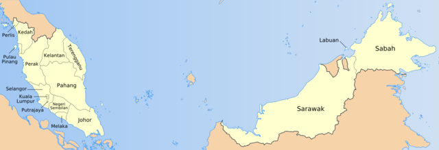
English: Map of the states of Malaysia, named in local terms. |
| Date | |
| Fonte | Originally own work by uploader based on PD CIA material, using other sources to estimate the borders of Putrajaya. This version is based on File:Malaysia location map.svg |
| Autor | Golbez, Mdzafri |
Autorisation
I, the copyright holder of this work, hereby publish it under the following licenses:

|
Permission es concedet por copiar, distribuer e/o modificar ti document sub li conditiones del Autorisation de Documentation Líber del GNU, Version 1.2 o qualcunc version posteriori publicat per li Free Software Foundation; che nequant Section Ínvariant, nequant Textu de Covriment, e nequant Textu de Contra-Covriment. Un copie del autorisation es includet in li section nominat Autorisation de Documentation Líber del GNU. |
| Ti file is autorisat sub li autorisation Creative Commons - Atribution-Distribution in Conditiones de Egal Autorisation 3.0 Non-Adaptat. | ||
Vu posse far in qualcunc forme rasonabil, ma ne de forma que suggeste que li autorisator indossa vu o tui usu.
| ||
| This licensing tag was added to this file as part of the GFDL licensing update. |
This file is licensed under the Creative Commons Attribution 2.5 Generic license.
- Vu es líber:
- distribuer – a copiar, distribuer e transmisser li labor
- remixter – adaptar li ovre
- Sub li conditiones quam seque:
- atribution – Vu deve dar li credite convenent, provider un catenun por li autorisation, e indicar si changes esset fat.
Vu posse far in qualcunc forme rasonabil, ma ne de forma que suggeste que li autorisator indossa vu o tui usu.
Vu posse selecter li autorisation de tui selection.
Versiones del file
Clacca a un date/témpore por vider ti version.
| Version de | Miniatura | Dimensiones | Usator | Comentarie | |
|---|---|---|---|---|---|
| actual | 10:57, 19 julí 2009 | 1,500 × 513 (163 KB) | Mdzafri | Corrected error in Perlis labeling and using a more detailed map. | |
| 00:44, 25 januar 2006 | 1,500 × 513 (34 KB) | Golbez | Better location for a couple of names. | ||
| 09:35, 24 januar 2006 | 1,500 × 513 (34 KB) | Golbez | Map of the states of Malaysia, named in English/local terms I think. Made by User:Golbez, based on PD CIA material, using other sources to estimate the borders of Putrajaya. Category:Maps of Malaysia |
Usu del file
Hay nequant págine que usa ti file.
Usu global del file
Li altri wikis a sequer usa ti-ci file:
- Usu in ace.wikipedia.org
- Usu in an.wikipedia.org
- Usu in ar.wikipedia.org
- Usu in az.wikipedia.org
- Usu in ban.wikipedia.org
- Usu in bg.wikipedia.org
- Usu in br.wikipedia.org
- Usu in csb.wikipedia.org
- Usu in cs.wikipedia.org
- Usu in da.wikipedia.org
- Usu in diq.wikipedia.org
- Usu in el.wikipedia.org
- Usu in en.wikipedia.org
- Usu in en.wikisource.org
- Usu in eu.wikipedia.org
- Usu in fa.wikipedia.org
- Usu in fi.wikipedia.org
Vider plu del usu global de ti-ci file.