File:Kingdom of France 1000.svg

Size of this PNG preview of this SVG file: 485 × 340 pixeles. Altri resolutiones: 320 × 224 pixeles | 640 × 449 pixeles | 1,024 × 718 pixeles | 1,280 × 897 pixeles | 2,560 × 1,795 pixeles.
Original file ((file SVG, nominalmen 485 × 340 pixeles, mesura de file: 1.22 MB))
Descrition
This W3C-unspecified vector image was created with Inkscape .


.svg)
.svg)
.svg)
.svg)
.svg)


.svg)
.svg)
.svg)


.png)
.png)


.svg)


.svg)

.svg)


.svg)
.svg)
.svg)
.svg)


.svg)
.png)


.svg)


.svg)
.svg)


.svg)


.svg)


.svg)
.svg)
.svg)
.svg)
.svg)
.svg)
.svg)
.svg)
_cropped.svg)
.svg)
.svg)
.svg)
.svg)
.svg)
.svg)
.svg)
.svg)
.svg)
.svg)
.svg)
.svg)
.svg)
.svg)
.svg)
.svg)
.svg)
.svg)
.svg)
.svg)
.svg)
.svg)
.svg)
.svg)
.svg)
.svg)
.svg)
.svg)
.svg)
.svg)
.svg)
.svg)
.svg)
.svg)
.svg)
.svg)
.svg)
.svg)
.svg)
.svg)
.svg)
.svg)
.svg)
.svg)
.svg)
Autorisation
This file is licensed under the Creative Commons Attribution-Share Alike 4.0 International license.
- Vu es líber:
- distribuer – a copiar, distribuer e transmisser li labor
- remixter – adaptar li ovre
- Sub li conditiones quam seque:
- atribution – Vu deve dar li credite convenent, provider un catenun por li autorisation, e indicar si changes esset fat.
Vu posse far in qualcunc forme rasonabil, ma ne de forma que suggeste que li autorisator indossa vu o tui usu.
- distribuer in conditiones de egal autorisation – Si vu remixter, transformar, o constructer sur li materiale, vu deve distribuer tui contributiones sub li autorisation identic o campatabil quam li original.
Versiones del file
Clacca a un date/témpore por vider ti version.
| Version de | Miniatura | Dimensiones | Usator | Comentarie | |
|---|---|---|---|---|---|
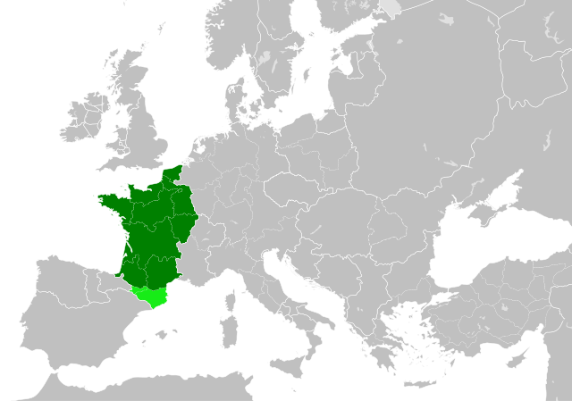
| actual | 22:55, 19 julí 2023 | | 485 × 340 (1.22 MB) | DaniCBP | The counties of Barcelona and Aragon were autonomous (de facto independent) and not an integral part of the realm) |
| 16:22, 23 may 2016 |  | 485 × 340 (1.25 MB) | Alphathon | Corrected Flanders and incorporated some islands into their respective counties/duchies | |
| 14:41, 23 may 2016 |  | 485 × 340 (1.25 MB) | Alphathon | Corrected status of Bohemia | |
| 18:13, 22 may 2016 |  | 485 × 340 (1.23 MB) | Alphathon | Split Capua from Benevento and removed both from HRE, along with Spoleto | |
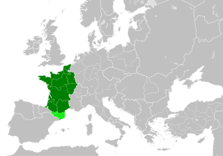
| 16:46, 22 may 2016 |  | 485 × 340 (1.24 MB) | Alphathon | == {{int:filedesc}} == {{Inkscape}} {{Information |Description={{en|A map of the en:Kingdom of France within Europe circa 1000 CE. The main subdivisions of the Byzantine Empire, Holy Roman Empire, Burgundy, France and Poland are also shown.}} |So... |
Usu del file
Li sequent págine usa ti file:
Usu global del file
Li altri wikis a sequer usa ti-ci file:
- Usu in arz.wikipedia.org
- Usu in cs.wikipedia.org
- Usu in da.wikipedia.org
- Usu in en.wikipedia.org
- Usu in es.wikipedia.org
- Usu in fa.wikipedia.org
- Usu in he.wikipedia.org
- Usu in it.wikipedia.org
- Usu in ko.wikipedia.org
- Usu in mn.wikipedia.org
- Usu in nrm.wikipedia.org
- Usu in simple.wikipedia.org
- Usu in sl.wikipedia.org
- Usu in th.wikipedia.org
- Usu in tr.wikipedia.org
- Usu in uk.wikipedia.org
- Usu in ur.wikipedia.org
- Usu in vi.wikipedia.org
- Usu in www.wikidata.org
- Usu in zh.wikipedia.org
.svg)