File:Karta FP Societe isl.PNG
Nequant resolution max alt disponibil.
Karta_FP_Societe_isl.PNG (450 × 400 pixeles, dimension del file: 6 KB, tip MIME: image/png)
Descrition
| Descrition |
Deutsch: Karte der Gesellschaftsinseln, Französisch Polynesien
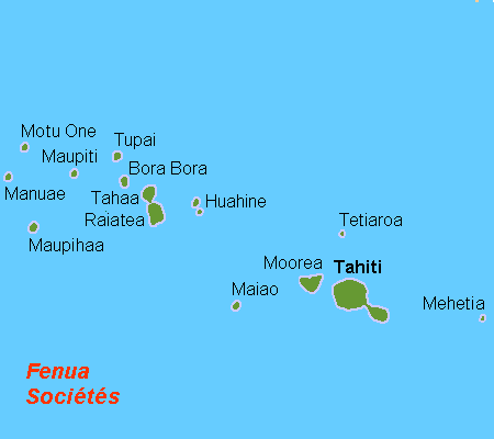
English: Map (rough) of the Society Islands, French Polynesia, own work composed from various mapreferences
Svenska: Karta över Sällskapsöarna, Franska Polynesien |
| Date | |
| Fonte | Propri ovre |
| Autor | Hobe / Holger Behr |
Autorisation
| I, the copyright holder of this work, release this work into the public domain. This applies worldwide. In some countries this may not be legally possible; if so: I grant anyone the right to use this work for any purpose, without any conditions, unless such conditions are required by law. |

|
This locator map image could be re-created using vector graphics as an SVG file. This has several advantages; see Commons:Media for cleanup for more information. If an SVG form of this image is available, please upload it and afterwards replace this template with
{{vector version available|new image name}}.
It is recommended to name the SVG file “Karta FP Societe isl.svg”—then the template Vector version available (or Vva) does not need the new image name parameter. |
Versiones del file
Clacca a un date/témpore por vider ti version.
| Version de | Miniatura | Dimensiones | Usator | Comentarie | |
|---|---|---|---|---|---|
| actual | 13:08, 21 april 2007 | | 450 × 400 (6 KB) | Hobe | karta Societeisl FP, Holger Behr, own work |
Usu del file
Hay nequant págine que usa ti file.
Usu global del file
Li altri wikis a sequer usa ti-ci file:
- Usu in af.wikipedia.org
- Usu in ar.wikipedia.org
- Usu in bg.wikipedia.org
- Usu in bn.wikipedia.org
- Usu in br.wikipedia.org
- Usu in ca.wikipedia.org
- Usu in ckb.wikipedia.org
- Usu in cs.wikipedia.org
- Usu in da.wikipedia.org
- Usu in de.wikipedia.org
- Usu in de.wikivoyage.org
- Usu in el.wikipedia.org
- Usu in en.wikipedia.org
- Raʻiātea
- Tetiʻaroa
- Windward Islands (Society Islands)
- Maupiti
- Motu One (Society Islands)
- Society Islands
- Maiʻao
- Maupihaʻa
- Mehetiʻa
- Wikipedia:Graphics Lab/Map workshop/Archive/Dec 2011
- Wikipedia:Graphics Lab/Map workshop/Archive/May 2012
- Wikipedia:Graphics Lab/Map workshop/Archive/Jul 2012
- The Brando Resort
- Society Islands tropical moist forests
- Usu in eo.wikipedia.org
Vider plu del usu global de ti-ci file.