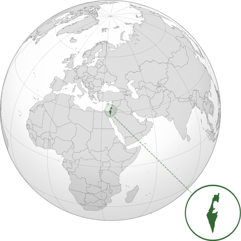
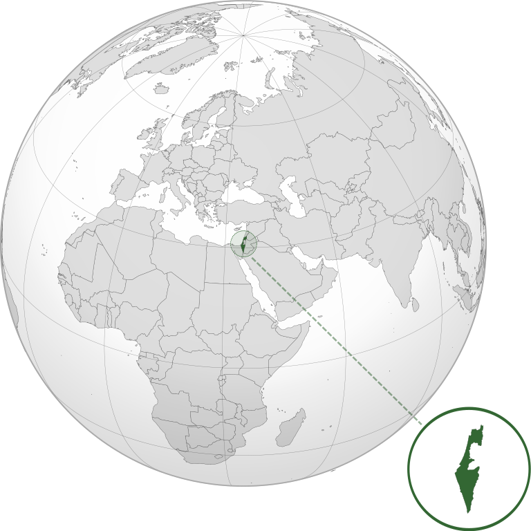
File:ISR orthographic.svg

Size of this PNG preview of this SVG file: 600 × 600 pixeles. Altri resolutiones: 240 × 240 pixeles | 480 × 480 pixeles | 768 × 768 pixeles | 1,024 × 1,024 pixeles | 2,048 × 2,048 pixeles.
Original file ((file SVG, nominalmen 600 × 600 pixeles, mesura de file: 1.39 MB))
Descrition
| Descrition | |
| Date | |
| Fonte |
Propri ovre with Natural Earth Data This W3C-unspecified vector image was created with Inkscape . |
| Autor | Addicted04 |
Autorisation
I, the copyright holder of this work, hereby publish it under the following license:
Ti file is autorisat sub li autorisation Creative Commons - Atribution-Distribution in Conditiones de Egal Autorisation 3.0 Non-Adaptat.
- Vu es líber:
- distribuer – a copiar, distribuer e transmisser li labor
- remixter – adaptar li ovre
- Sub li conditiones quam seque:
- atribution – Vu deve dar li credite convenent, provider un catenun por li autorisation, e indicar si changes esset fat.
Vu posse far in qualcunc forme rasonabil, ma ne de forma que suggeste que li autorisator indossa vu o tui usu.
- distribuer in conditiones de egal autorisation – Si vu remixter, transformar, o constructer sur li materiale, vu deve distribuer tui contributiones sub li autorisation identic o campatabil quam li original.
Versiones del file
Clacca a un date/témpore por vider ti version.
| Version de | Miniatura | Dimensiones | Usator | Comentarie | |
|---|---|---|---|---|---|
| actual | 03:46, 17 marte 2022 | | 600 × 600 (1.39 MB) | Chaddy | Reverted to version as of 06:27, 24 March 2019 (UTC), there is already another map for the disputed borders: File:Israel (orthographic projection) with disputed territories.svg |
| 09:48, 10 marte 2022 |  | 600 × 600 (1.4 MB) | Beshogur | Reverted to version as of 06:25, 24 March 2019 (UTC) | |
| 06:27, 24 marte 2019 |  | 600 × 600 (1.39 MB) | BlueHypercane761 | Reverted to version as of 22:09, 21 September 2016 (UTC) Self-revert. As legitimate as this revision is, I will split it off into a new image file. | |
| 06:25, 24 marte 2019 |  | 600 × 600 (1.4 MB) | BlueHypercane761 | Restoring previous revision temporarily to retrieve image. | |
| 22:09, 21 septembre 2016 |  | 600 × 600 (1.39 MB) | Nableezy | make a new map, this one is fine | |
| 18:50, 16 septembre 2016 |  | 600 × 600 (1.4 MB) | Bolter21 | added disputed territories | |
| 03:06, 8 julí 2012 |  | 600 × 600 (1.39 MB) | Addicted04 | America land | |
| 02:42, 8 julí 2012 |  | 600 × 600 (1.39 MB) | Addicted04 |
_with_disputed_territories.svg)
Usu del file
Li sequent págine usa ti file:
Usu global del file
Li altri wikis a sequer usa ti-ci file:
- Usu in af.wikipedia.org
- Usu in am.wikipedia.org
- Usu in arc.wikipedia.org
- Usu in av.wikipedia.org
- Usu in ay.wikipedia.org
- Usu in azb.wikipedia.org
- Usu in az.wiktionary.org
- Usu in ban.wikipedia.org
- Usu in bbc.wikipedia.org
- Usu in bcl.wikipedia.org
- Usu in bg.wikipedia.org
- Usu in bh.wikipedia.org
- Usu in bi.wikipedia.org
- Usu in bn.wikipedia.org
- Usu in bs.wikipedia.org
- Usu in bxr.wikipedia.org
- Usu in cdo.wikipedia.org
- Usu in ceb.wikipedia.org
- Usu in chr.wikipedia.org
- Usu in ckb.wikipedia.org
- Usu in cs.wikipedia.org
- Usu in da.wikipedia.org
- Usu in dty.wikipedia.org
- Usu in el.wikipedia.org
- Usu in en.wikipedia.org
- Usu in en.wikibooks.org
- Usu in es.wikipedia.org
- Usu in eu.wikipedia.org
- Usu in fi.wikipedia.org
- Usu in fr.wikipedia.org
- Usu in gn.wikipedia.org
- Usu in gu.wikipedia.org
- Usu in gv.wikipedia.org
- Usu in hak.wikipedia.org
- Usu in hr.wikipedia.org
- Usu in hy.wikipedia.org
- Usu in id.wikipedia.org
- Usu in incubator.wikimedia.org
Vider plu del usu global de ti-ci file.