File:Holstentor in Lübeck 2015.jpg

Dimension de ci prevision: 800 × 533 pixeles. Altri resolutiones: 320 × 213 pixeles | 640 × 427 pixeles | 1,024 × 683 pixeles | 1,280 × 853 pixeles | 2,560 × 1,707 pixeles | 10,958 × 7,306 pixeles.
Original file (10,958 × 7,306 pixeles, dimension del file: 48.23 MB, tip MIME: image/jpeg)
| Warning | The original file is very high-resolution. It might not load properly or could cause your browser to freeze when opened at full size. |
|---|
| Descrition |
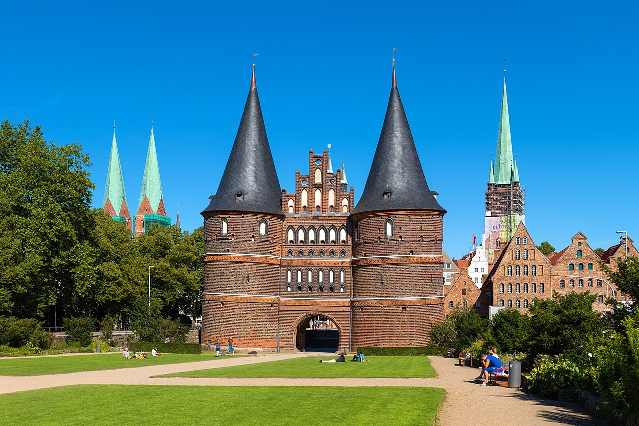
English: Holstentor in Lübeck, Germany. View from Holstenplatz. You can also see the steeples from Marienkirche (Lübeck) and Petrikirche (Lübeck) (from left), three of the seven steeples of Lübeck. In the front the historical Salzspeicher.
Deutsch: Holstentor in Lübeck, Sicht vom Holstentorplatz. Auch zu sehen die Türme der Marienkirche (links) und der Turm der Petrikirche (rechts), drei der Sieben Türme Lübecks. Vor der Petrikirche die historischen Salzspeicher. |
| Date | |
| Fonte | Propri ovre |
| Autor | Christian Wolf (www.c-w-design.de) |
| Permission: (Reusant ti-ci file) |
I, the copyright holder of this work, hereby publish it under the following license: This file is licensed under the Creative Commons Attribution-Share Alike 3.0 Germany license. Atribution: Christian Wolf (www.c-w-design.de)
Vu posse far in qualcunc forme rasonabil, ma ne de forma que suggeste que li autorisator indossa vu o tui usu.
 |
| Other versions |
Frontansicht des Tors vom Holstentorplatz (Großansicht und Zuschnitt), Stadtansicht von der Brücke
|


| Camera location | | View this and other nearby images on: OpenStreetMap |
|---|
Descrition
| Camera Model | Canon EOS 750D |
|---|---|
| Shutter speed | 1/400 s |
| Aperture | f/8 |
| Film speed (ISO) | 100 |
| Focal length | 70 mm (single image / Einzelbild) |
| Flash | no / nein |
Assessment
|
This image has been assessed using the Quality image guidelines and is considered a Quality image.
|
Autorisation
This image is not public domain. Please respect the copyright protection. It may only be used according to the rules mentioned here. This specifically excludes use in social media, if applicable terms of the licenses listed here not appropriate.
|

| Please do not upload an updated image here without consultation with the Author. The author would like to make corrections only at his own source. This ensures that the changes are preserved.
Please if you think that any changes should be required, please inform the author. Otherwise you can upload a new image with a new name. Please use one of the templates derivative or extract. |
Versiones del file
Clacca a un date/témpore por vider ti version.
| Version de | Miniatura | Dimensiones | Usator | Comentarie | |
|---|---|---|---|---|---|
| actual | 23:58, 3 januar 2016 | | 10,958 × 7,306 (48.23 MB) | Dr. Chriss | {{Information |Description ={{en|1=Holstentor in Lübeck, Germany. View from Holstenplatz }} {{de|1=Holstentor in Lübeck, Sicht vom [[:de:Holstentorplatz|Holstent... |
Usu del file
Li sequent págine usa ti file:
Usu global del file
Li altri wikis a sequer usa ti-ci file:
- Usu in azb.wikipedia.org
- Usu in da.wikipedia.org
- Usu in de.wikipedia.org
- Usu in de.wikivoyage.org
- Usu in en.wikipedia.org
- Usu in eo.wikivoyage.org
- Usu in fr.wikipedia.org
- Usu in it.wikipedia.org
- Usu in lt.wikipedia.org
- Usu in mg.wikipedia.org
- Usu in pt.wikipedia.org
- Usu in simple.wikipedia.org
- Usu in ur.wikipedia.org
- Usu in vi.wikipedia.org
- Usu in zh.wikipedia.org