File:EU-Croatia.svg

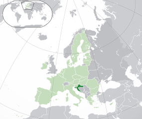
Size of this PNG preview of this SVG file: 713 × 600 pixeles. Altri resolutiones: 285 × 240 pixeles | 571 × 480 pixeles | 913 × 768 pixeles | 1,218 × 1,024 pixeles | 2,435 × 2,048 pixeles | 2,045 × 1,720 pixeles.
Original file ((file SVG, nominalmen 2,045 × 1,720 pixeles, mesura de file: 7.33 MB))
Descrition
| Descrition |
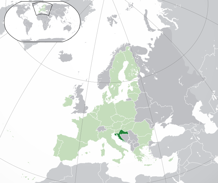
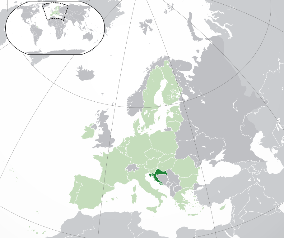
Français : (Vert) Croatie
(Vert clair) : Union Européenne (UE) (Gris) : Europe (Gris clair) : Région avoisinanteEnglish: (Green) : Croatia
(Light-green) : The European Union (EU) (Grey) : Europe (Light grey) : The surrounding region. |
| Date | |
| Fonte | Propri ovre |
| Autor | {{Atoine85}} |
| Other versions |
|
| SVG genesis |


Autorisation
I, the copyright holder of this work, hereby publish it under the following license:
Ti file is autorisat sub li autorisation Creative Commons - Atribution-Distribution in Conditiones de Egal Autorisation 3.0 Non-Adaptat.
- Vu es líber:
- distribuer – a copiar, distribuer e transmisser li labor
- remixter – adaptar li ovre
- Sub li conditiones quam seque:
- atribution – Vu deve dar li credite convenent, provider un catenun por li autorisation, e indicar si changes esset fat.
Vu posse far in qualcunc forme rasonabil, ma ne de forma que suggeste que li autorisator indossa vu o tui usu.
- distribuer in conditiones de egal autorisation – Si vu remixter, transformar, o constructer sur li materiale, vu deve distribuer tui contributiones sub li autorisation identic o campatabil quam li original.
Versiones del file
Clacca a un date/témpore por vider ti version.
| Version de | Miniatura | Dimensiones | Usator | Comentarie | |
|---|---|---|---|---|---|
| actual | 04:43, 1 februar 2020 | | 2,045 × 1,720 (7.33 MB) | Rob984 | UK and Gibraltar have left the EU. New base which includes all of Portugal's islands within frame, as well as Arctic Russian islands part of Europe. Also fixed Flevoland in the Netherlands. |
| 16:54, 25 octobre 2016 |  | 2,045 × 1,720 (7.32 MB) | Giorgi Balakhadze | fix | |
| 16:37, 25 octobre 2016 |  | 2,045 × 1,720 (7.33 MB) | Giorgi Balakhadze | Rv of sockpuppet and per COM:OVERWRITE | |
| 16:26, 18 marte 2015 |  | 2,045 × 1,720 (7.38 MB) | Mapclean | Reverted to Leftcry's version, please go to your talk page | |
| 14:03, 21 februar 2015 |  | 2,044 × 1,719 (2.03 MB) | VS6507 | Spain. Greece. Slovakia. Cyprus. Romania VETO | |
| 19:35, 16 novembre 2014 |  | 2,045 × 1,720 (7.38 MB) | Leftcry | Reverted to version as of 22:33, 18 October 2014 Please go to your talk page | |
| 16:21, 16 novembre 2014 |  | 2,044 × 1,719 (2.03 MB) | A2D2 | The map must show the original de-jure status with no breakaway regions, as it was originally created. An alternative map showing the de-facto status with breakaway regions needs to created instead. | |
| 15:42, 16 novembre 2014 |  | 2,045 × 1,720 (7.38 MB) | A2D2 | Reverted to version as of 12:10, 16 August 2014 | |
| 22:33, 18 octobre 2014 |  | 2,045 × 1,720 (7.38 MB) | Leftcry | Minor fix | |
| 12:10, 16 august 2014 |  | 2,045 × 1,720 (7.38 MB) | DIREKTOR | Fixed overview. |
Usu del file
Li sequent págine usa ti file:
Usu global del file
Li altri wikis a sequer usa ti-ci file:
- Usu in ace.wikipedia.org
- Usu in ady.wikipedia.org
- Usu in af.wikipedia.org
- Usu in ami.wikipedia.org
- Usu in ar.wikipedia.org
- كرواتيا
- مستخدم:ElWaliElAlaoui/ملعب 8
- معاملة المثليين في كرواتيا
- مستخدم:جار الله/قائمة صور مقالات العلاقات الثنائية
- العلاقات الأمريكية الكرواتية
- العلاقات الأنغولية الكرواتية
- العلاقات الكرواتية الكورية الجنوبية
- العلاقات الإريترية الكرواتية
- العلاقات السويسرية الكرواتية
- العلاقات الألمانية الكرواتية
- العلاقات الكرواتية الليختنشتانية
- العلاقات البوليفية الكرواتية
- العلاقات الكرواتية الموزمبيقية
- العلاقات الألبانية الكرواتية
- العلاقات البلجيكية الكرواتية
- العلاقات الإثيوبية الكرواتية
- العلاقات البيلاروسية الكرواتية
- العلاقات الطاجيكستانية الكرواتية
- العلاقات الروسية الكرواتية
- العلاقات الرومانية الكرواتية
- العلاقات الأرجنتينية الكرواتية
- العلاقات الغامبية الكرواتية
- العلاقات القبرصية الكرواتية
- العلاقات السيراليونية الكرواتية
- العلاقات الكرواتية النيبالية
- العلاقات الكرواتية الليبيرية
- العلاقات التشيكية الكرواتية
- العلاقات الكرواتية الميانمارية
- العلاقات الكرواتية الكندية
- العلاقات الزيمبابوية الكرواتية
- العلاقات الإسرائيلية الكرواتية
- العلاقات البالاوية الكرواتية
- العلاقات الكرواتية المالية
- العلاقات الكرواتية النيجيرية
- العلاقات اليمنية الكرواتية
- العلاقات الفانواتية الكرواتية
- العلاقات الغابونية الكرواتية
- العلاقات البنمية الكرواتية
- العلاقات الكرواتية الكوبية
- العلاقات الجورجية الكرواتية
- العلاقات الكرواتية الكورية الشمالية
- العلاقات الهندية الكرواتية
- العلاقات اليابانية الكرواتية
- العلاقات الإيطالية الكرواتية
- العلاقات الكرواتية الناوروية
- العلاقات الأسترالية الكرواتية
Vider plu del usu global de ti-ci file.