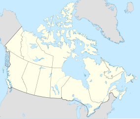
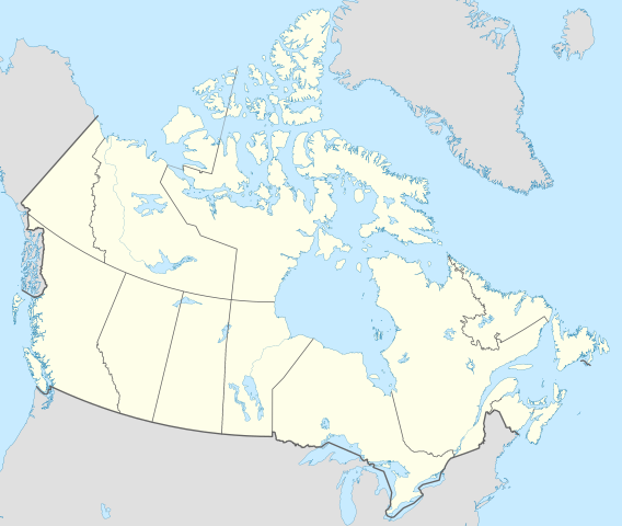
File:Canada location map 2 - lite.svg

Size of this PNG preview of this SVG file: 709 × 600 pixeles. Altri resolutiones: 284 × 240 pixeles | 568 × 480 pixeles | 908 × 768 pixeles | 1,211 × 1,024 pixeles | 2,422 × 2,048 pixeles | 1,114 × 942 pixeles.
Original file ((file SVG, nominalmen 1,114 × 942 pixeles, mesura de file: 279 KB))
Descrition
| Descrition |
English: Location map of Canada with all five Great Lakes shown in full.
This is a lite version of the map with most rivers removed. |
| Date | |
| Fonte | Propri ovre |
| Autor | MapGrid |
| Other versions |
|
| SVG genesis |


Map Info
| Projection: | Lambert conformal conic |
|---|---|
| Datum: | WGS84 |
| Central Meridian: | 95.000000°W |
| Latitude of Origin: | 60.000000°N |
| Standard Parallel #1: | 49.000000°N |
| Standard Parallel #2: | 77.000000°N |
| x (%)= | 201.7818903*(((tan(pi*(90-$1)/360))*(((1+0.08181919084*sin(pi*$1/180))/(1-0.08181919084*sin(pi*$1/180)))^0.04090959542))^0.9007900864)*sin(0.01572175288*($2+95))+43.98563734
|
|---|---|
| y (%)= | 238.6252927*(((tan(pi*(90-$1)/360))*(((1+0.08181919084*sin(pi*$1/180))/(1-0.08181919084*sin(pi*$1/180)))^0.04090959542))^0.9007900864)*cos(0.01572175288*($2+95))-15.81495465
|
| $1: | latitude in degrees (positive for all locations in Canada). |
| $2: | longitude in degrees (negative for all locations in Canada). |
| x (%): | x coordinate expressed as percentage of image width (measured from left edge). |
| y (%): | y coordinate expressed as percentage of image height (measured from top edge). |
| x (px) | y (px) | x (%) | y (%) | Latitude | Longitude | |
|---|---|---|---|---|---|---|
| Top Left Corner: | 0.000 | 0.000 | 0.00 | 0.00 | 68.220310°N | 176.138684°W |
| Top Right Corner: | 1114.000 | 0.000 | 100.00 | 0.00 | 62.238635°N | 9.994317°W |
| Bottom Right Corner: | 1114.000 | 942.000 | 100.00 | 100.00 | 34.831244°N | 61.953430°W |
| Bottom Left Corner: | 0.000 | 942.000 | 0.00 | 100.00 | 37.392537°N | 121.850536°W |
| Centre: | 557.000 | 471.000 | 50.00 | 50.00 | 63.068962°N | 88.152750°W |
| Origin: | 490.000 | 541.000 | 43.99 | 57.43 | 60.000000°N | 95.000000°W |
| North Pole: | 490.000 | -148.977 | 43.99 | -15.81 | 90.000000°N | ⸻ |
| Thechàl Dhâl: | 67.523 | 368.241 | 6.06 | 39.09 | 61.022873°N | 138.564925°W |
Autorisation
I, the copyright holder of this work, hereby publish it under the following license:
This file is licensed under the Creative Commons Attribution-Share Alike 4.0 International license.
- Vu es líber:
- distribuer – a copiar, distribuer e transmisser li labor
- remixter – adaptar li ovre
- Sub li conditiones quam seque:
- atribution – Vu deve dar li credite convenent, provider un catenun por li autorisation, e indicar si changes esset fat.
Vu posse far in qualcunc forme rasonabil, ma ne de forma que suggeste que li autorisator indossa vu o tui usu.
- distribuer in conditiones de egal autorisation – Si vu remixter, transformar, o constructer sur li materiale, vu deve distribuer tui contributiones sub li autorisation identic o campatabil quam li original.
Versiones del file
Clacca a un date/témpore por vider ti version.
| Version de | Miniatura | Dimensiones | Usator | Comentarie | |
|---|---|---|---|---|---|
| actual | 17:36, 29 decembre 2020 | | 1,114 × 942 (279 KB) | MapGrid | Added an international boundary line between Canada and St Pierre & Miquelon (as per request). Slightly thinner provincial/territorial border to match new provincial/territorial locator maps. |
| 18:59, 25 decembre 2020 |  | 1,114 × 942 (279 KB) | MapGrid | Christmas Day edition... added the Nelson River | |
| 22:45, 22 novembre 2020 |  | 1,114 × 942 (269 KB) | MapGrid | Added Mackenzie River. And a few minor tweaks. | |
| 19:03, 15 novembre 2020 |  | 1,114 × 942 (264 KB) | MapGrid | Uploaded own work with UploadWizard |
Usu del file
Hay nequant págine que usa ti file.
Usu global del file
Li altri wikis a sequer usa ti-ci file:
- Usu in azb.wikipedia.org
- Usu in bh.wikipedia.org
- Usu in en.wikipedia.org
- Geography of Canada
- Politics of Canada
- Economy of Canada
- Monarchy of Canada
- List of Canadian provincial and territorial symbols
- Music of Canada
- Same-sex marriage in Canada
- First Nations in Canada
- List of universities in Canada
- Index of Canada-related articles
- National Historic Sites of Canada
- Template:Subdivisions of Ontario
- Template:Administrative divisions of Quebec
- Template:Subdivisions of British Columbia
- List of current first ministers of Canada
- Egale Canada
- Same-sex marriage in Yukon
- Extreme points of Canada
- Universities Canada
- Same-sex marriage in Ontario
- Same-sex marriage in Quebec
- Same-sex marriage in British Columbia
- Same-sex marriage in Manitoba
- Same-sex marriage in Nova Scotia
- List of universities and colleges in New Brunswick
- Same-sex marriage in Nunavut
- Same-sex marriage in Alberta
- Same-sex marriage in Saskatchewan
- Same-sex marriage in New Brunswick
- Same-sex marriage in Newfoundland and Labrador
- Same-sex marriage in Prince Edward Island
- Same-sex marriage in the Northwest Territories
- Civil unions in Quebec
- Members of the 38th Canadian Parliament and same-sex marriage
- Reference Re Same-Sex Marriage
- Civil Marriage Act
- Canadians for Equal Marriage
- Template:Subdivisions of Alberta
- Template:Same-sex marriage in Canada
- Template talk:Same-sex marriage in Canada
- Template:Subdivisions of New Brunswick
- Scouting and Guiding in Quebec
- List of colleges in Canada
- Scouting and Guiding in Canada
- LGBTQ rights in Canada
- Template:Subdivisions of Saskatchewan
- Template:Subdivisions of Nova Scotia
Vider plu del usu global de ti-ci file.