File:2004 Praha.png
Nequant resolution max alt disponibil.
2004_Praha.png (619 × 356 pixeles, dimension del file: 12 KB, tip MIME: image/png)
Descrition
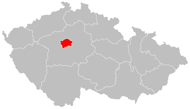
| Descrition |
Čeština: Lokační mapa Prahy od 2004 English: Locator map of Prague from 2004 |
| Date | |
| Fonte | File:2004_Stredocesky_kraj.PNG |
| Autor | Hustoles |
Autorisation
| This file is made available under the Creative Commons CC0 1.0 Universal Public Domain Dedication. | |
| The person who associated a work with this deed has dedicated the work to the public domain by waiving all of their rights to the work worldwide under copyright law, including all related and neighboring rights, to the extent allowed by law. You can copy, modify, distribute and perform the work, even for commercial purposes, all without asking permission.
|
Versiones del file
Clacca a un date/témpore por vider ti version.
| Version de | Miniatura | Dimensiones | Usator | Comentarie | |
|---|---|---|---|---|---|
| actual | 21:10, 2 januar 2016 | | 619 × 356 (12 KB) | Valdemar | new borders (law no. 15/2015 Coll.) |
| 16:38, 24 august 2011 |  | 619 × 356 (16 KB) | Fext |
Usu del file
Li sequent págine usa ti file:
Usu global del file
Li altri wikis a sequer usa ti-ci file:
- Usu in ang.wikipedia.org
- Usu in ar.wikipedia.org
- Usu in arz.wikipedia.org
- Usu in ast.wikipedia.org
- Usu in ca.wikipedia.org
- Usu in ceb.wikipedia.org
- Usu in cs.wikipedia.org
- Usu in cs.wikiversity.org
- Usu in diq.wikipedia.org
- Usu in el.wikipedia.org
- Usu in es.wikipedia.org
- Usu in eu.wikipedia.org
- Usu in ext.wikipedia.org
- Usu in fr.wikinews.org
- Usu in ga.wikipedia.org
- Usu in glk.wikipedia.org
- Usu in gl.wikipedia.org
- Usu in ha.wikipedia.org
- Usu in ht.wikipedia.org
- Usu in ia.wikipedia.org
- Usu in kab.wikipedia.org
- Usu in la.wikipedia.org
- Usu in mdf.wikipedia.org
- Usu in mt.wikipedia.org
- Usu in mzn.wikipedia.org
- Usu in pl.wikivoyage.org
- Usu in ro.wikipedia.org
- Usu in rue.wikipedia.org
- Usu in tt.wikipedia.org
- Usu in uk.wikipedia.org
- Usu in ur.wikipedia.org
- Usu in vls.wikipedia.org
- Usu in vo.wikipedia.org
- Usu in www.wikidata.org
- Usu in zh-yue.wikipedia.org