File:PER orthographic.svg

Size of this PNG preview of this SVG file: 551 × 551 pixeles. Altri resolutiones: 240 × 240 pixeles | 480 × 480 pixeles | 768 × 768 pixeles | 1,024 × 1,024 pixeles | 2,048 × 2,048 pixeles.
Original file ((file SVG, nominalmen 551 × 551 pixeles, mesura de file: 1.23 MB))
Descrition
| Descrition |
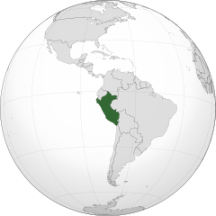
English: A map of the hemisphere centred on -75, -9, using an orthographic projection, created using gringer's Perl script with Natural Earth Data (1:50000 resolution, simplified to 0.25px). Peru is highlighted in green.
Peru |
| Date | |
| Fonte | Propri ovre with Natural Earth Data |
| Autor | Addicted04 |
| SVG genesis |
Autorisation
I, the copyright holder of this work, hereby publish it under the following license:
Ti file is autorisat sub li autorisation Creative Commons - Atribution-Distribution in Conditiones de Egal Autorisation 3.0 Non-Adaptat.
- Vu es líber:
- distribuer – a copiar, distribuer e transmisser li labor
- remixter – adaptar li ovre
- Sub li conditiones quam seque:
- atribution – Vu deve dar li credite convenent, provider un catenun por li autorisation, e indicar si changes esset fat.
Vu posse far in qualcunc forme rasonabil, ma ne de forma que suggeste que li autorisator indossa vu o tui usu.
- distribuer in conditiones de egal autorisation – Si vu remixter, transformar, o constructer sur li materiale, vu deve distribuer tui contributiones sub li autorisation identic o campatabil quam li original.
Versiones del file
Clacca a un date/témpore por vider ti version.
| Version de | Miniatura | Dimensiones | Usator | Comentarie | |
|---|---|---|---|---|---|
| actual | 03:09, 27 julí 2018 | | 551 × 551 (1.23 MB) | LeinadCQ | Oculto lagos. |
| 06:56, 6 januar 2015 |  | 551 × 551 (1.23 MB) | Denniss | Reverted to version as of 00:37, 20 January 2014 | |
| 03:37, 6 januar 2015 |  | 1,800 × 1,400 (534 KB) | Mondolkiri1 | Perú en UNASUR /Peru na UNASUL | |
| 00:37, 20 januar 2014 |  | 551 × 551 (1.23 MB) | Addicted04 | New map | |
| 22:26, 10 decembre 2011 |  | 550 × 550 (918 KB) | Addicted04 |
Usu del file
Li sequent págine usa ti file:
Usu global del file
Li altri wikis a sequer usa ti-ci file:
- Usu in ar.wikipedia.org
- مستخدم:جار الله/قائمة صور مقالات العلاقات الثنائية
- العلاقات الأمريكية البيروية
- العلاقات الأنغولية البيروية
- العلاقات البيروية الكورية الجنوبية
- العلاقات الإريترية البيروية
- العلاقات البيروية السويسرية
- العلاقات الألمانية البيروية
- العلاقات البيروية الليختنشتانية
- العلاقات البوليفية البيروية
- العلاقات البيروية الموزمبيقية
- العلاقات الألبانية البيروية
- العلاقات البلجيكية البيروية
- العلاقات الإثيوبية البيروية
- العلاقات البيروية البيلاروسية
- العلاقات البيروية الطاجيكستانية
- العلاقات البيروية الروسية
- العلاقات البيروية الرومانية
- العلاقات الأرجنتينية البيروية
- العلاقات البيروية الغامبية
- العلاقات البيروية القبرصية
- العلاقات البيروية السيراليونية
- العلاقات البيروية النيبالية
- العلاقات البيروية الليبيرية
- العلاقات التشيكية البيروية
- العلاقات البيروية الميانمارية
- العلاقات البيروية السعودية
- العلاقات البيروية الزيمبابوية
- العلاقات الإسرائيلية البيروية
- العلاقات البالاوية البيروية
- العلاقات البيروية المالية
- العلاقات البيروية النيجيرية
- العلاقات البيروية اليمنية
- العلاقات البيروية الفانواتية
- العلاقات البيروية الغابونية
- العلاقات البنمية البيروية
- العلاقات البيروية الكوبية
- العلاقات البيروية الجورجية
- العلاقات البيروية التونسية
- العلاقات البيروية الكورية الشمالية
- العلاقات البيروية الهندية
- العلاقات البيروية اليابانية
- العلاقات الإيطالية البيروية
- العلاقات البيروية الناوروية
- العلاقات الأسترالية البيروية
- العلاقات البيروية الزامبية
- العلاقات البيروية الفيجية
- العلاقات البيروية المارشالية
- العلاقات الأذربيجانية البيروية
- العلاقات البيروية السودانية
- العلاقات البيروية الكويتية
Vider plu del usu global de ti-ci file.